Introduction to the Southwest Region of China
There are eight provinces involved in the southwest China program of the International Plant Nutrition Institute, including Tibetan Autonomous District, Guangxi Autonomous District of Zhuang Nationality, Chongqing City, and provinces of Sichuan province, Yunnan, Guizhou, Guangdong and Hainan.
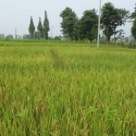
This region, ranging from the ridge of the world in the northwest – Tibet plateau down to the sea level in the southeast– Hainan Island and spanning from temperate to tropical climate, is most diverse in landscapes, climate, soil types, and cropping systems in China. In the Tibetan plateau, grassland accounts for 60% and cultivated land for about 0.3% of its land area where crops have one harvest a year. In the Sichuan Basin (Sichuan and Chongqing) – north Guizhou, purple soils and yellow earth prevail. With hilly landscapes and subtropical climate, particularly mild winter, major cropping systems are rice-wheat (rape), wheat-corn (sweet potato/soybean), vegetables, fruits (citrus) and potato with two harvests a year. In the provinces of Yunnan, Guangxi and Guangdong, red soils and latosolic red soils dominate and major crop rotations are rice-rice, sugarcane, subtropical fruits with two to three harvests a year. On the Hainan Island with lower latitudes at 17.5-200S and a tropical monsoon climate, extremely hot, or cold, weather is absent and thus, plants flourish with perennial green grass and blooming flowers. Rice-rice, vegetables, subtropical and tropic fruits and other economic crops grow on the laterite soils with three harvests a year.
The major problems identified in relation to soil and nutrient management in the past are (1) severe soil erosion present in Yunan, Sichuan, Chongqing and Guizhou; (2) widely spread soil nutrient deficiencies of N, K, P and B in the whole region, deficiencies of Ca, S and Mg in Yunnan, Guangxi, Guangdong and Hainan; and deficiencies of Fe and Zn on alkaline soils; (3) high nutrient leaching from soils in Hainan, Guangdong, Guanxi and Yunnan; (4) inadequate fertilizer input in Tibet and parts of Sichuan, Yunnan and Guizhou (180 kg/ha in 2008) and high fertilizer input in Hainan(563 kg/ha in 2008), Guangdong and Guangxi; and (5) soil acidification that was caused by acid rains in one decade ago, but now mainly resulting from high rates of N fertilizers which is particularly true for soils grown vegetables, fruits and some other high value crops. Some of the crops such as banana, sugarcane and vegetables require high rates of fertilizers to obtain desired yields and quality. The high nutrient input brings about tremendous demand on nutrient management technology and knowledge dissemination.
More detailed description of different provinces is given below in an order of Hainan, Guangdong, Guangxi, Guizhou, Chongqing, Sichuan, Yunnan and Tibet.
Hainan
Hainan province, also known as the Coco Island and abbreviated as Qiong, is the second largest island in China after Taiwan, and whose capital is Haikou city. Hainan covers more than two million sq. km in area including 34,000 sq. km of land and has a population of over seven million, of which 120,000 are Ni, Miao, and other minorities. To its north is Guangdong province with Qiongzhou channel between them; to its west Beibu Bay separates it from Vietnam; to the east is Hong Kong and Taiwan; the Philippines are to the southeast; and the south sea connects it with Malaysia, Indonesia, and Singapore. Thus Hainan is located in the heart of the Pacific economic zone of Asia.
The island lies in a tropics and has a tropical monsoon climate. The annual average temperature in Hainan province is 23.8 celcius and total annual precipitation is 1,639 mm. Extremely hot, or cold, weather is absent on the island because of pleasant, cool winds in summer and warm sunlight in winter. Plants in Hainan flourish with perennial green grass and blooming flowers and the rate of vegetative cover is as high as 50 percent.
Basalt and sea deposits prevail as soil parent materials which have developed into highly weathered laterites. Besides these soils is a band of dry laterite soils which is located along the western coast. All of these soils are light in texture, poor in fertility, and nutrients deficiencies such as phosphorus (P), potassium (K), calcium (Ca), magnesium (Mg), boron (B), and molybdenum (Mo) are the very common problems for crop production. Furthermore, high rainfall exacerbate nutrient leaching from both the indigenous soil nutrient pool as well as from added fertilizers. It is no wonder that crops on the island consume higher fertilizer rates to produce the same quantity of agricultural products compared to other parts of China. Therefore, balanced fertilization and the technology of proper fertilizer application becomes extremely important in the area in order to improve the crop quality and yield, and to increase farmers’ income and reduce environment contamination.
Being the production base of tropical crops in China, the main crops in Hainan province are most diverse and include rice, sugarcane, all kinds of tropical fruits including mango, banana, litchi, pineapple and coco, oil plants, vegetables and other economic crops such as rubber plant (No. 1 in China in both planting area and yield), coffee bean, cashew, spiceberry, sisal, pepper and cassava and so on...
Guangdong
Guangdong province is located between 20013′- 25031′N and 109041′- 117020′E. It occupies a land area of 178.1 thousand sq. km (1.86% of China) and has a cultivated land area of 2,229,400 ha. The population reached 104.3 million in 2010, with the largest population of Han people along with 52 minorities such as Zhuang, Yao, Hui, etc.
Landscapes
The province has high elevation to its north and low elevation in the south and the landscapes reveal a great diversity from mountainous regions (33%), hills (25%), plains (22%), and mesas (14%).
Climate and VegetationMost of the province is under control of the sub-tropical monsoon climate and a portion is affected by a tropical monsoon climate. The distinct climatic characteristics can be described as a long summer, a shorter warm winter, ample rainfalls, clear rainy and dry seasons, frequent typhoons and rainstorms in summer and autumn, and occasional extreme chilly days in winter and spring. The average annual temperatures are between 18 to 23.2 ℃, the total annual precipitation is around 1,700 to 2,200 mm, the rain seasons span from April to September and dry seasons from November to January, and the rest of a year is in between. There are roughly 290 frost-free days in the north and no frost in the south. Vegetation on the land is in great variety with clear regional distribution including tropical, sub-tropical monsoon rain forests and subtropical ever-green broadleaf forests scattered throughout its extents. Due to over-logging in the past, some areas suffer from severe soil erosion (an estimated 7,376.3 sq. km, about 4.14% of the land area in the province).
Agriculture
The major grain crops include rice, upland grain crops, and tuber crops, and the major cash crops consist of sugarcane, peanut, tobacco, herbs, vegetables, soybean, and tea, and all kinds of fruits such as litchi, longan, banana, citrus, pineapple, mango and so on. The major tropical and sub-tropical crops are latex, pepper, and sisal. Fruits production in Guangdong ranks the second in China, but the well-known litchi and banana is No. 1 in China in terms of planted area and yield. Major cropping rotation systems are rice-rice, rice-rice-vegetable, rice-rice-green manure, vegetable-vegetable, and peanut-sweet potato.
Soils and Fertility
The main soil types are laterite (44.7%), red soil (21.0%), paddy soil (14.8%), acid sulfate soil (8.1%), yellow earth (5.3%) and lateritic red soil (4.4%). Soils are developed from granite, basalt, arenaceous shale, and alluvial deposits. Generally, soil fertility is poor for laterite and lateritic red soil, medium to high for red soils, variable for paddy soils depending on the parent materials from which the soil is developed. The acidic sulfate soil is high in organic matter (OM), nitrogen (N), potassium (K) but low in phosphorus (P). Yellow earth is commonly fertile but deficient in P. Soil tests from 52300 soil samples in recent years shows that near 40% of soils are deficient in K and 60% in Mg, but have remarkable P accumulation in the vegetable soils at the Pearl River Delta region.
Fertilizer Application
More emphasis has been put on K through balanced fertilizer research, demonstration and extension through different means of technology transfer. This has remarkably promoted use of potash in the province. At the end of 2010, fertilizer rates in Guangdong reached 223-47-103-148 kg N-P2O5-K2O-compound/ha, with a N: P2O5: K2O ratio of 1: 0.21: 0.4 which is much more balanced than most other provinces in China. Nevertheless, inadequate use of K in some crops is still a common problem. Besides, magnesium (Mg) and sulfur (S) are not considered in the routine fertilizer program.
Guangxi
Guangxi province is located between 20054′- 26020′ N and 104029′- 112004′E. To its south is Beibu Bay; to its north is the Nanling mountains; the Yunnan-Guizhou Plateau lies to its west. It covers an area of 237,000 sq. km and has a population about 46.03 million including Han nationality and fifteen other minorities such as Zhuang (accounting for 32.7% of the total population), Han, Miao, Yao, Tong, Hui, Jing, Yi, Shui, Maonan, Mulam, Gelam, and so on. The overall landform slants from northwest to southeast and is a mosaic of landscapes including: mesas, basins, hills, hornitos, and small plains. The province receives ample solar radiation and is strongly influenced by the dry and wet monsoons in the winter and the summer. There is a great diversity of soil parent materials, such as granite, sandstone, limestone, argillite and red earth from the Quaternary period as well as glacial tills. The cultivated land area is 2,614,200 ha, accounting for 11 % of the total land, of which 1,540,300 ha is paddy fields and 1,073,900 ha upland, accounting for 58.9% and 41.1% of total cultivated land, respectively.
Features of Landscapes
Mountainous region: There is about 9,325,000 ha of land over 400 m above sea level, accounting for 28.9% of total land in Guangxi. This land-type is mainly located in the northeast and western regions of the province.
Hills: The hills occupy an area of 6,840,000 ha with an elevation of 200 to 400 m, accounting for 18.4% of total land in Guangxi. They are mainly distributed at the edges of the high and medium mountain regions and at the main river banks, often seen in the southeast, south and central regions of the province.
Barren Stone Mountains: The province is well-known for its karst landscape in China, with an area of 5,345,000 ha or 18.4% of the total land, distributed throughout the province.
Mesas: The mesas, less than 200 m in elevation, cover 1,491,000 ha or 6.3% of the total land in the south, central, southwest and southeast regions.
Plains :About 5,538,000 ha of land area are considered as plains and are distributed in the southern coastal area, southeast, central, and valleys of the Zhuo River.
Main Soil Types: According to Chinese soil taxonomy, there are 18 soil types in Guangxi. Lateritic soil and red soil are the two major soil types, accounting for 65% of the total land area. Of secondary importance are the yellow earth, paddy, purple, and limestone soils. The major nutrient disorders in the cultivated soils are deficiencies of nitrogen (N) (83%), phosphorus (P) (85%), and potassium (K) (87%). Calcium (Ca), magnesium (Mg) and molybdenum (Mo) are also deficient in the acidic soils. Acid soils account for 67% of the total while calcareous soils account for the remainder.
Climate
Guangxi enjoys a warm subtropical climate with annual temperatures of 16 to 23 Celsius. Day temperatures are between 5.5 to 15.2 Celsius in January and 27 to 29 Celsius in July. An extremely hot day temperature can be up to 42 Celsius while the coldest is rarely less than 0 Celsius. The frost free period is usually around 284 to 365 days a year. Total annual precipitation in Guangxi is between 1,000 to 2,800 mm. There are usually 240 to 358 days per year that reach temperatures above 10 Celsius and annual accumulative temperatures range between 5,000 to 8,300 Celsius with 1,300 to 2,250 hrs of sunlight.
Agriculture
Rice is the major crop in paddy fields, which with the exception of the cool mountain areas, harvest two crops per year. In the upland fields, corn, sugarcane, peanut, soybean, sweet potato, and cassava are the common crops. The main cropping systems are corn-peanut, corn-potato, peanut-soybean, peanut-potato, and paddy rice-vegetable-vegetable, vegetable-paddy rice-vegetable. Sugarcane, cassava, banana, and citrus are the main crops in the uplands. The multi-cropping index is 220% and the rate of vegetative cover is 38.2%.
Guizhou
Guizhou province, as the major part of the Yunnan-Guizhou Plateau, is located between 24037′- 29013′N and 103036′- 109035′E. Hunan province lies to its east; to its south is Guangxi province; Yunnan province along its western border, and to its north is Sichuan province and Chongqing municipality. Guizhou has an area of 176,167 sq. km (1.8% of the county), farmland area of 4487.5 thousand ha and a population of 34.75 million, including Han nationality and the other 47 minorities, such as Miao, Buyi, Ton, Tujia, Yi, Hui, Bai, and so on, with a population of 13 million (accounting for 37.9% of the total population).
Climate
Located in the subtropical humid monsoon zone, Guizhou enjoys a warm and humid climate with cool summers and mild winters.
Table 1 Some selected climatic data in Guizhou in 2001
| Number | Comments |
| Average annual temperature (C) | 14 | |
| Temperatures in January (C) | 3-6 | higher than other areas at the same latitude |
| Temperature in July (C) | 22-25 | typical cool summer |
| Annual precipitation (mm) | 924.3 | |
| Sunny days (hrs) | 921.5 | |
| Frost free days (d) | 270 |
The overall landscape slants from the centre region to the north, east and south, with an average elevation of around 1,100 m. The province is mountainous where mountains and hills account for 92.5% of the total land and the reminder is comprised of small basins and valleys. The well-known karst landscapes prevail with an area of 109,084 sq. km, accounting for 61.9% of total land, and form a great diversity of shapes, casting a special ecosystem.
Soils
Guizhou has a land surface area of 159,100 sq. km or 90.4% of total land in the province. There are 19 soil types in Guizhou. Yellow earth and yellow-brown soils are the major soil types, followed by the limestone soil, purple soil, gravel soil, paddy soil, brown soil, alluvial soil, peat soil, bog soil, and so on. According to the second soil survey, slightly acid soils, acid soils, neutral soils, and calcareous soils account for 35.7%, 18.4%, 31.0%. and 14.8%, respectively. The nutrient status in the cultivated soils is given in Table 2. It is obvious that the soils have relatively poor soil fertility.
Table 2 Nutrient status in the cultivated soils
| Nutrient | Content | Evaluation |
| Organic matter (%) | 3.9 | Medium-high |
| Total N (%) | 0.20 | medium |
| Total P (%) | 0.06 | Medium |
| Available P (mg/kg) | 8.1 | Lower |
| Total K (%) | 1.6 | Low |
| Available K (mg/kg) | 124.4 | Medium |
The soils are commonly deficient in boron (B) (69.5%), zinc (Zn) (40.2%), molybdenum (Mo) (22.2%), and sufficient in copper (Cu), manganese (Mn) and iron (Fe).
Agriculture
Agriculture plays a dominant role in Guizhou’s revenues. The main grain crops include paddy rice, corn, wheat, sorghum, soybean, potato, and the cash crops are tobacco, tea, silkworm, sugarcane, vegetables, rape, hemp, and fruits.
Crop yields are relatively low (Table 3) compared to most of other provinces in China. The main cropping systems are paddy rice-rape/wheat and corn-rape/wheat. The rate of forest cover is 30.8%, equivalent to 0.14 ha per capita.
Table 3 Cropping areas and yield in Guizhou in 2010
| Crops | Seeding area (ha) | Total yield ( t) | Yield (kg/ha) |
| Paddy rice | 698,200 | 4,532,000 | 6,490 |
| Corn | 751,500 | 4,052,000 | 5,392 |
| Potato | 635,000 | 1,535,000 | 2,417 |
| Rape | 466,900 | 704,000 | 1,508 |
| Tea | 132,200 | 41,883 | 317 |
| Sugarcane | 164,000 | 642,700 | 39,117 |
| Vegetables | 625,300 | 11,350,000 | 18,419 |
| Fruits | 140,800 | 642,161 | 4,560 |
Fertilizers application
In 2010, the total fertilizer consumption (nutrients) was 865,900 t, with 470,000 t of nitrogen (N), 109,100 t of phosphorus (P2O5), 75,000 t of potash (K2O) and 212,000 t of compound fertilizers. The N: P2O5: K2O ratio was around 1: 0.26: 0.12. The total planting area was 4.78 million ha, with an average N-P2O5-K2O-compound application rate of 98-23-16-44 kg/ha. It is clear that is large potential exists for fertilizer consumption in the province, especially for P and K.
Chongqing
Chongqing used to be a part of Sichuan province but was municipalized in 1997. Since then, it has become the biggest economic centre in the upper reaches of the Yangtze River. Being at the confluence of the Yangtze River and Jialingjiang River, Yu, the abbreviation of its capital city – Chongqing is named after it. The region covers a land area of 82,403 sq. km and has 1,405,000 ha of cultivated land (4,500 ha of sloping lands between 5 to 25 degrees and 36,200 ha >25 degrees). By the end of 2010 the total population reached 28,85 million.
The average annual temperatures are between 18 to 19 C, precipitation is 1,100 to 1,200 mm and frost free days are around 325 to 345 days. With a low rate of vegetative cover of 23.1%, most lands suffer from severe soil erosion, accounting for 63.6% of the total lands with an average erosion rate of 4,261 t/sq. km. per year. The total amount of soils eroded is 222 million t a year, of which about 70 million t is washed into rivers - an astonishing high figure.
Soils and Soil Fertility
The major soil parent materials are those outcrops from the Mesozoic, followed by Paleozoic sea sediments. There are 11 soil types including paddy soil (45.6%), purple soil (34.7%), and yellow soil (16.0%). Land with medium to low productivity accounts for 83.8% of the total. Soil testing from 1992 to 2002 shows a slight increase in organic matter and total nitrogen (N), a decrease in potassium (K), and no noticeable change for available phosphorus (P) - compared to the second soil survey conducted in 1980’s. Available zinc (Zn) and boron (B) are still deficient in most soils and molybdenum (Mo) in acid soils in particular. Soil acidification is worsening in vegetable soils causing many problems both in nutrient disorders and diseases. Total fertilizer consumption is 912,000 t (of nutrients) at a N: P2O5: K2O ratio of 1: 0.4: 0.1. The fertilizer application rate was 276 kg/ha in 2010.
Crops
Paddy rice, corn, tuber crops (sweet potato, potato), and wheat are the main grain crops, and cash crops are rape, tea, mulberry for silk worms and citrus. The dominant cropping rotation is wheat-corn-potato in the hilly uplands and corn-potato in the mountainous region. Citrus grown in Fengjie county is well-known nationwide in China for its high quality. Kidney bean, berberine, southernwood and other local special produce from Wuling and Qingbai mountainous regions are making good fortunes for local farmers through export.
Sichuan
Sichuan province, heavily populated, and situated in southwest China, is a large inland province known for its agricultural production capabilities. Its population was 80.42 million at the end of 2010 which accounts for 6.0% of China's total population, ranking 4th amongst provinces in China. Known as the Land of Abundance, Sichuan is abundant in natural resources and endowed with favorable natural conditions. The province grows various kinds of crops and produces ample agricultural products. Chongqing used to be a part of Sichuan province and became autonomous in 1998. Since then Sichuan lost its leading position in population and its land area also fell from 567,400 sq. km to 485,000 sq. km of today.
A Vast Territory with Complicated Landscapes
The Sichuan basin lies in the eastern portion of the province and mountainous regions surround it to the north and southwest. The plateau, with series of mountains and gorges, occupies its western reaches. There are varieties of landforms, including plains (7.8%), hills (10.1%), plateaus or mountains (32.1%), mountainous regions (49.4%), water (0.6%). The agricultural land is mainly distributed in the hilly basin region and on the Chengdu Plain.
Limited Farming Land
There are 4,346,100 ha of cultivated land, accounting for 4.8% of total ag land in China, of which 2,249,600 ha are paddy fields and the remainder is uplands. On average, there is only 0.053 ha of farmland per capita.
Favorable Climate for Agricultural Production
The Sichuan Basin, located in the eastern region, has a humid sub-tropical climate with relatively higher temperatures than the other parts of China at the same latitude. The annual temperature is above 16 C and the frost free days are usually around 220 to 330 days a year; the total annual precipitation is between 1,000 to 1,400 mm and sunny days are 1000 to 1600 hrs a year, which is the lowest in China. The mountainous region, lying in the southwest of Sichuan, has no clear-cut for the four seasons with cool summer and warm winter, but has distinct dry and wet seasons with annual temperatures around 14 to 20 C and 240 to 330 frost free days. The total annual precipitation is between 900 to 1,200 mm and sunny days are 2,200 to 2,700 hrs a year, especially in the area of Panzihua city, which is called as the Golden Triangle or the Treasure Bowl in the upper reaches of Yangtze River, where annual temperature is around 14 to 20 C and crops can be harvested 3 times a year, similar to the tropics of Southern Asia. The river valleys have the longest summer and no winter, with abundant agricultural production in grains, sugarcane and other sub-tropical fruits (mango, guava, and grape). The plateau with high mountains and deep gorges, located in western Sichuan, though there receives ample solar radiation, usually has chilly winters and cool summers due to insufficient heat and precipitation at such high elevations (2,000 to 5,000 m). As a whole, the average annual temperature is 4 to 12 C, frost free days are 100 to 200 days a year, the annual precipitation is 500 to 900 mm and sunny days are 1,600 to 2,600 hrs a year (twice of that in Sichuan Basin).
Crops
The seeded area (multi-crops a year are counted) was 1,796,900 ha in 2010. The multi-cropping index is 104.4%. Rice, wheat, corn and sweet potato are the four main staple food crops. There are also various other economic crops, such as cotton, rape, sugarcane, fruits (citrus, peach, apple, pear, loquat, plum, apricot, Chinese gooseberry, watermelon, strawberry etc.), vegetable, tea, tobacco, hemp, Chinese herbs and so on.
Importance of Agricultural Products and Sideline Products in China
Being the reliable production basin for grain and non - staple food, Sichuan province plays a leading role in producing grains, edible oils, hemp, sugarcane, mulberry, tea, fruits, Chinese herbs, tobacco, etc. in China.
Table 4 Agricultural production and its ranking in China
Agricultural production | Percentage of China (%) | Rank in China |
Agricultural production value (14.835 billion yuan) | 5.62 | 6 |
Grains | 7.2 | 6 |
Edible oils | 5.83 | 3 |
Vegetables | 4.8 | 7 |
Pigs | 1 | |
Pork, beef and mutton meat | 9.16 | 1 |
Soil - types and Fertilizer Consumption
There are 19 types of soils which mainly include yellow earth, purple soil, paddy soil, red soil, limestone soils, and alluvial soil. These soils generally have medium to medium high soil fertility and certain nutrient disorders often occur. In general, deficiencies of nitrogen (N), phosphorus (P) and potassium (K) are common problems of nutrient disorder in the cultivated soils. Phosphorus deficiency, however, is more serious in the soils growing grain crops than in the those growing cash crops, but the latter is more deficient in K. As for soil pH, deficiencies of K, Ca, Mo, and B are common in acid soils, while deficiencies of Fe, Zn, and B are common in calcareous soils.
In 2010 the total fertilization consumption in Sichuan was 2,480,000 t (of nutrient), ranking 7th in China, with an application rate of 262 kg/ha. Of the fertilizers consumed, there were 1,307,000 t of N, 497,000 t of P2O5, 164,000 t of K2O, and 503,000 t of compound fertilizers. The N: P2O5: K2O ratio for all fertilizer nutrients consumed in 2010 was 100: 37.7: 18.3, indicating there is still a great potential for increased P and K consumption in future.
Yunnan
Yunnan province enjoys fame as the kingdom of mountains, the hometown of rivers, and is a treasure bowl of plant genes. There are more than 18,000 species of higher plants (including 2,500 ornamental, 6,100 herbs, and over 60 spiceberries), 1,700 types of vertebrates and more than 10,000 kinds of insects. Han people and about another 26 minorities, including Yi, Bai, Zhuang, Miao, Dai, and Hui with a population of 45.97 million, live in Yunnan.
Geographic location and landscapes
Situated in China’s southwestern border region, the province is contiguous with Guangxi and Guizhou provinces to the east; towering mountains in the northwest adjoin the border of Tibet; to the north is the most populous Sichuan province; to its south, southwest and west parts are Vietnam, Laos, and Burma, respectively. The territory is 394,000 sq. km. The geographical features in the province are diverse and spectacular. The terrain slopes sharp down from the northwest to the southwest. The highest point of this highland reaches the 6,740 m Kagebo Peak in the snowy Meili Mt. on the Yunnan-Tibet border, while the lowest point is 76.4 m along the Sino-Vietnam border. The Nujiang River (called the Mekong in Laos and Vietnam) and the Jinshajiang River (the upper reaches of the Yangtze River) flow under snow-capped peaks where the Zhujiang River and Red River are also originated from. The major landforms in Yunnan are mountains (84%), highlands (10%), small basins and valleys (6%). Vegetative cover is up to 40%, and the area with soil erosion and water loss is about 14,000 sq. km, accounting for 37% of total land in the province.
Table 5 Classification of cultivated land in Yunnan province.
Land | Area, ha | Percentage | Comments |
Total cultivated land | 6,567,500 | 100 | Sloping land is predominant in Yunnan province |
Slope class | |||
<2 degree | 768,100 | 11.69 | |
2~6 | 855,500 | 13.03 | |
>6 | 4,943,900 | 75.28 |
Yunnan people are often proud of their unique, pleasant, subtropical monsoon climate without hot summers or harsh winters. Due to peculiar geographical environment, complex landforms and sharp falls and rises in elevation, diversified climatic conditions result. Temperatures vary with the ascent of terrain. In general, there are only small differences in temperature between months. Clear differences in precipitation exist between dry and rainy seasons. The precipitation is between 800 to 1,300 mm in most areas with 85% falling from May to October.
Soil types and fertilizers
The soil parent materials are mainly debris from mountains, argillite, quartz, acidic rocks, limestone, purple rock, and lake sediments. The main soil types in the province are red soil, paddy soil, purple soil, and laterite. Over 70% of cultivated land is medium to low in productivity (with limitations due to slope, water-shortage, or poor fertility). Red soils developed from basalt are deficient in potassium (K) and phosphorus (P) with the exception of some suburb soils that are showing signs of P accumulation. Most crops have nutrient disorders.
In 2010, fertilizers consumption was 1.17 million t of nutrients. After great efforts made through research, demonstration and education on balanced fertilization, the majority of the farmers have started to understand the concept. With improvement in farmers fertilizer practice, the improved fertilizer use ratio (N: P2O5: K2O) is now recommended at 1: 0.47:0.41.
Crops and cropping rotation
The main crops in province are paddy rice, corn, wheat, barley, beans (broadbean, pea, and soybean), potato, vegetables, tobacco, sugarcane, tea, rubber, flowers, pineapple, banana, mango, coffee, and buckwheat. The cropping rotations are paddy rice-broadbean, paddy rice-wheat, corn/tobacco-wheat, and corn/tobacco-bean.
Tibet
To the north of the Himalayas within the Chinese borders, lies the Tibet Autonomous Region of China - the Roof of the World, with an area of 1,228,400 square kilometers and a population of 2.32 million, of whom 95% are Tibetans. It is the highest plateau in the world, with an average elevation of 4,000 m, and Lhasa is its capital city.
Climate
Tibet enjoys rich solar radiation, adequate rainfall and tremendous fresh water resources. The weather conditions are suitable for growth of a number of highland crops such as wheat, barley, rape, and corn. Extremely hot or cold weather is absent in most of the agricultural area in Tibet as the average temperature in July and the lowest temperatures in winter are between -10 to 16 C. There is a great difference in day and night temperatures, favorable to the photosynthesis and yield of crops. Tibet receives ample heat and thus annual sunny days in Lhasa and Rikezhe are 2,939 to 3,249 hrs.
Cultivated land
Tibet has a land area of 1,228,400 sq. km, consisting of 2.30 million ha of cultivated land (0.31%), 392.15 million ha of grassland (56.7%) and 43.30 million ha of forest land (6.27). There is 2.75 million ha of land resource suitable for future reclamation. The farmland per capita is 1.13 ha, mainly distributed in the middle and lower reaches of Brahmaputra.
Table 6 Cultivated land distributions at different elevations in Tibet
Elevation (m) | Percentage of total cultivated land (%) | Comments |
<2,500 | 5.6 | The cultivated land distributed from 610 to 4,795 m, the highest farming land in the world. |
2,500-3,500 | 11.4 | |
3,500-4,100 | 60.8 | |
>4,100 | 22.2 | No crop, animal stock only |
Agriculture
There is diversity of agricultural production due to the varied elevations and landscapes and different temperatures and precipitation in Tibet (the highest is Everest, 8,848 m; the lowest is the Brahmaputra 100 m).
Table 7 Crops grown at different elevations in Tibet.
Elevation (m) | Crops | Harvests/year |
<2,300 | Paddy rice, corn, soybean, millet, spring/winter wheat, spring/winter highland barley, rape, pea | 2 |
2,300-3,000 | Spring/winter wheat, spring/winter highland barley, rape, pea | 2 or 3 |
3,000-3,800 | Spring highland barley, spring wheat, pea, rape | 1 |
4,100-4,300 | Spring highland barley, spring wheat, pea, rape | 1 |
| >4,300 | No crops and animal stock only |